Raleigh, NC
Drone & Aerial Photography in Raleigh, NC
FAA Part 107–licensed aerial photo and video — perfect for acreage, waterfront, and showing neighborhood context.
About Drone & Aerial Photography in Raleigh
Across western Wake (Cary, Apex, Holly Springs) and the new-construction corridors of Wake Forest and Knightdale, buyers want to see lot size, the community, and proximity to Research Triangle Park. Aerial drone imagery shows all of it at a glance, helping a resale listing stand out against builder inventory and giving relocation buyers the location context they can't judge from afar. Our FAA Part 107-licensed pilots capture it, delivered on the same next-business-day timeline as your photography.
What's included
- FAA Part 107–licensed pilots, fully insured
- 5–10 stills + optional 4K aerial video clips
- Lot lines and property boundary stills available
- Neighborhood context shots (parks, amenities, schools)
- Same-shoot bundle pricing when paired with photo
Why it matters
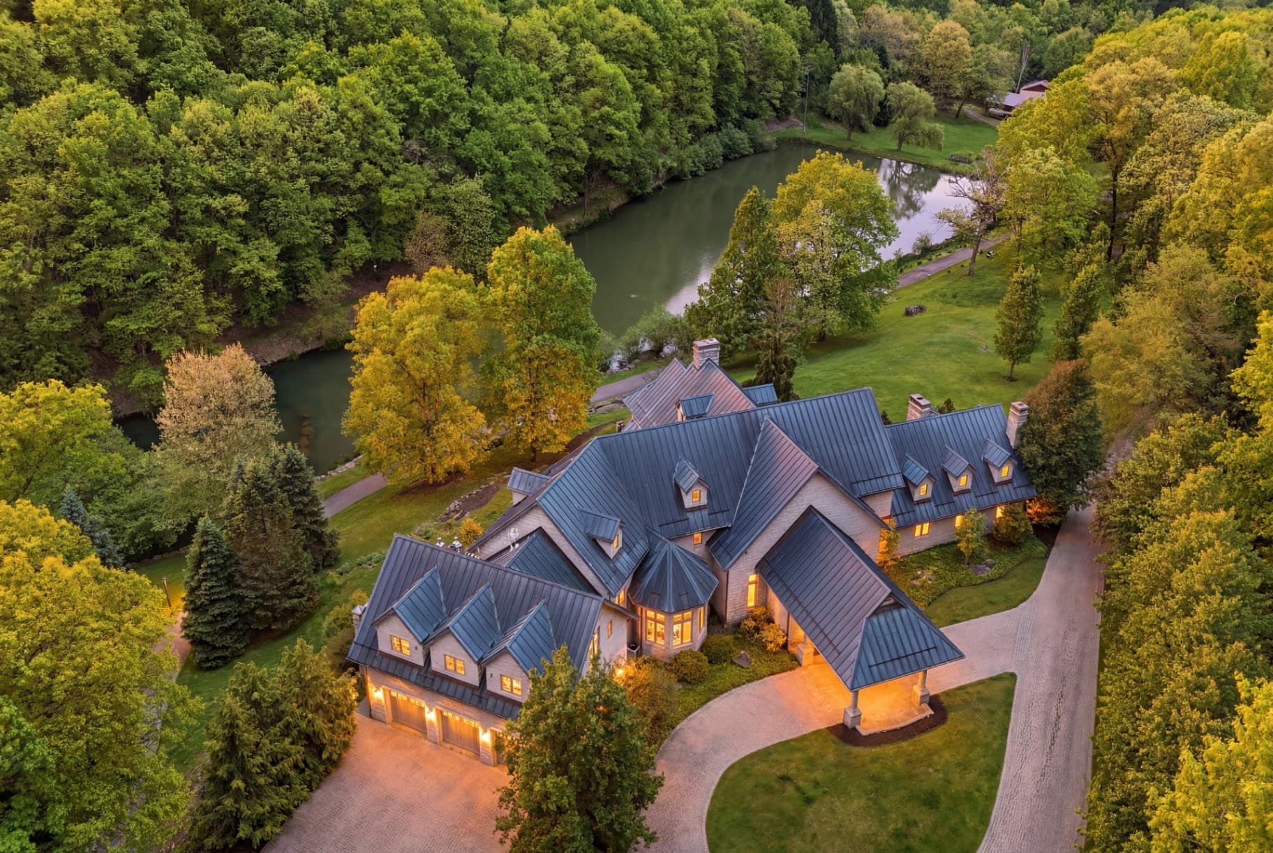
Aerials show what ground-level photos can't — lot size, surrounding amenities, water frontage, treeline, and how a property sits in its neighborhood. Required for serious listings over 1 acre, on water, or with a view.
Neighborhoods we serve in Raleigh
Downtown Raleigh · Inside the Beltline (ITB) · Five Points · Hayes Barton · North Hills · Midtown · Brier Creek · North Raleigh · Wakefield · Cary · Apex · Holly Springs · Fuquay-Varina · Garner · Knightdale · Wake Forest · Morrisville · Clayton
Drone & Aerial in Raleigh — FAQ
Which Raleigh listings benefit most from drone?
Homes on notable lots, new construction, and properties in western Wake and the growth corridors where lot, community, and RTP proximity are selling points.
Are your drone pilots FAA licensed?
Yes. All aerial work is flown by FAA Part 107-licensed, insured pilots in compliance with airspace rules.
Related reading: Real estate media in Raleigh, NC